History
15 million BCE - Present
A look back at how a stretch of unnamed rancho land became one of the East Bay's most distinctive small cities.
Fifteen million years ago, Orinda lay under a shallow sea, home to whales, clams, oysters, and starfish.
Ten million years ago, the rolling hills appeared, along with lakes and marshes. Antelope, horses, camels, mastodons, and hyenas roamed the land.
Ten thousand years ago, pre-Indigenous peoples from Asia and Alaska arrived. Mount Diablo and the Berkeley hills emerged in their familiar form, providing refuge for bison, foxes, coyotes, raccoons, and rabbits.
One thousand years ago, Costanoan (Ohlone) peoples sited their main tribal village near present-day Lafayette. Evidence of additional villages near Miner Road and Lauterwasse Creek surfaced in 1892 during construction of the California & Nevada Railroad. An extensive Indigenous burial ground also came to light in 1924 when work began on the Orinda Country Club golf course. The OCC's 11th hole sits on that ground today.
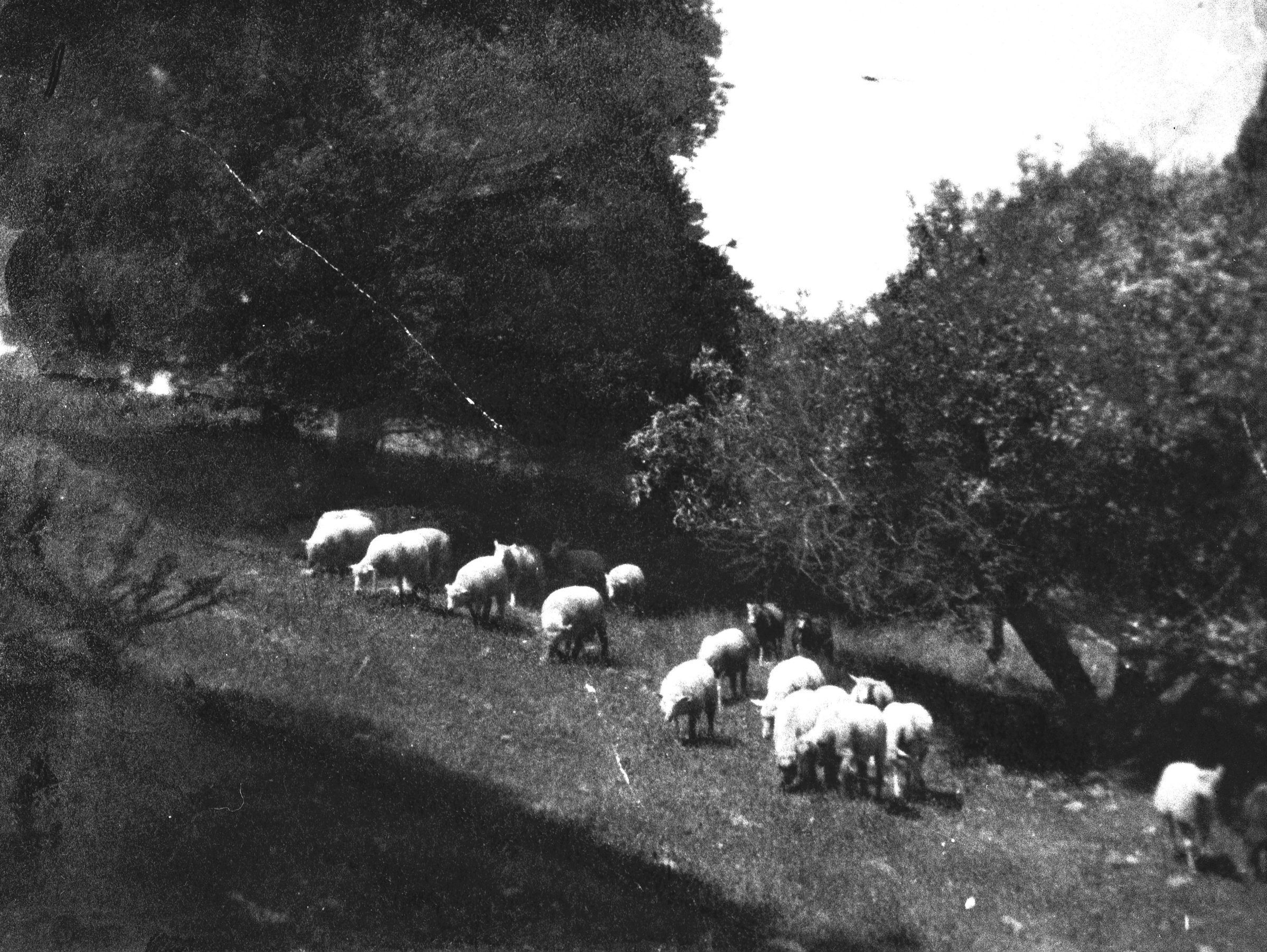
The Orinda area before American settlement was rural ranchland within four Mexican land grants.
Two hundred years ago, the Mexican government awarded four large land grants to Joaquin Moraga, Victor Castro, and other Mexican nationals in the area now known as Lamorinda. Today's Orinda sits within four of these grants: Rancho Laguna de los Palos Colorados, Rancho El Sobrante, Rancho Acalanes, and Rancho Boca de la Canada del Pinole.
By 1848, the American conquest of California was complete, and land began changing hands rapidly. Costanoan peoples, who had numbered around 7,000 at the time of American independence, were nearly extinct by 1910. Some of their artifacts can be found today in the Orinda History Museum.
In 1875, developer William Camron paid $20 per acre for 2,937 acres of what would become Orinda. His wife, Alice Marsh Camron, was devoted to the 17th-century English poet Katherine Philips, who wrote under the pen name "The Matchless Orinda." Alice insisted they call their new property Orinda Park.
Within eight years, William had lost all his money, deserted his family, and sold off 1,178 acres to Jose and Miguel de Laveaga, two brothers from San Francisco, for $50,880. By the dawn of the 20th century, "Park" had been dropped from the name, and the area was known simply as Orinda.
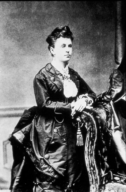
Alice Marsh Camron, who named Orinda after her favorite 17th-century poet, around the time of her marriage to William Camron.
One hundred years ago, E.I. de Laveaga began developing the valley west of San Pablo Creek. Orinda Village was born, complete with the Spanish street names that still define the area today (see the glossary below).Homes and amenities began to spring up, including the Orinda Country Club, a swimming pool, and a handsome golf course. E.I.'s granddaughters still live in Bien Venida, the home he grew up in.
Beautiful and balmy though Orinda was for weekenders, getting here used to be a real undertaking. Visitors put their lives in their hands every time they came through the terrifying 1903 tunnel or rode the short-lived narrow-gauge California & Nevada Railroad. (The train was not above derailing at "Frenchman's Curve" and asking all passengers to push it back onto the tracks. Read more about that.)
Everything changed when the Caldecott Tunnel opened in 1937. Suddenly Orinda was more than a place to picnic or play a round of weekend golf. By the time work began on BART in the late 1960s, Orinda was well on its way to becoming the residential community it is today.
Orinda was officially incorporated as a city on July 1, 1985. Its first mayor was Richard G. Heggie.
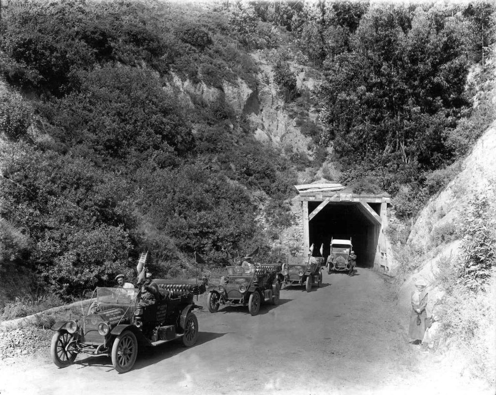
The 1937 opening of the Caldecott Tunnel transformed Orinda from a weekend retreat into a year-round community.
When E.I. de Laveaga laid out Orinda Village in the mid-1920s, he gave the streets beautiful Spanish names. A small selection of what they mean:
Bien Venida — Welcome
Camino del Diablo — Devil's Highway
Cresta Blanca — White Peak
El Toyonal — The Toyon, or Christmas Berry
Las Aromas — Sweet Smells
Linda Vista — Beautiful View
Lomas Cantadas — Singing Hills
Mira Flores — View of the Flowers
See the full glossary of Orinda's Spanish street names →
Orinda Schools – From a one-room schoolhouse to today →
The California-Nevada Railroad – Orinda's "rheumatic locomotive" →
Browse photos from this period in the Photo Archive →
Images of America: Orinda by Alison Burns (Arcadia Publishing, 2022)
The OHS newspaper archive: 824 issues of the Orinda Sun, 1948–1972
California Revealed digital collection